
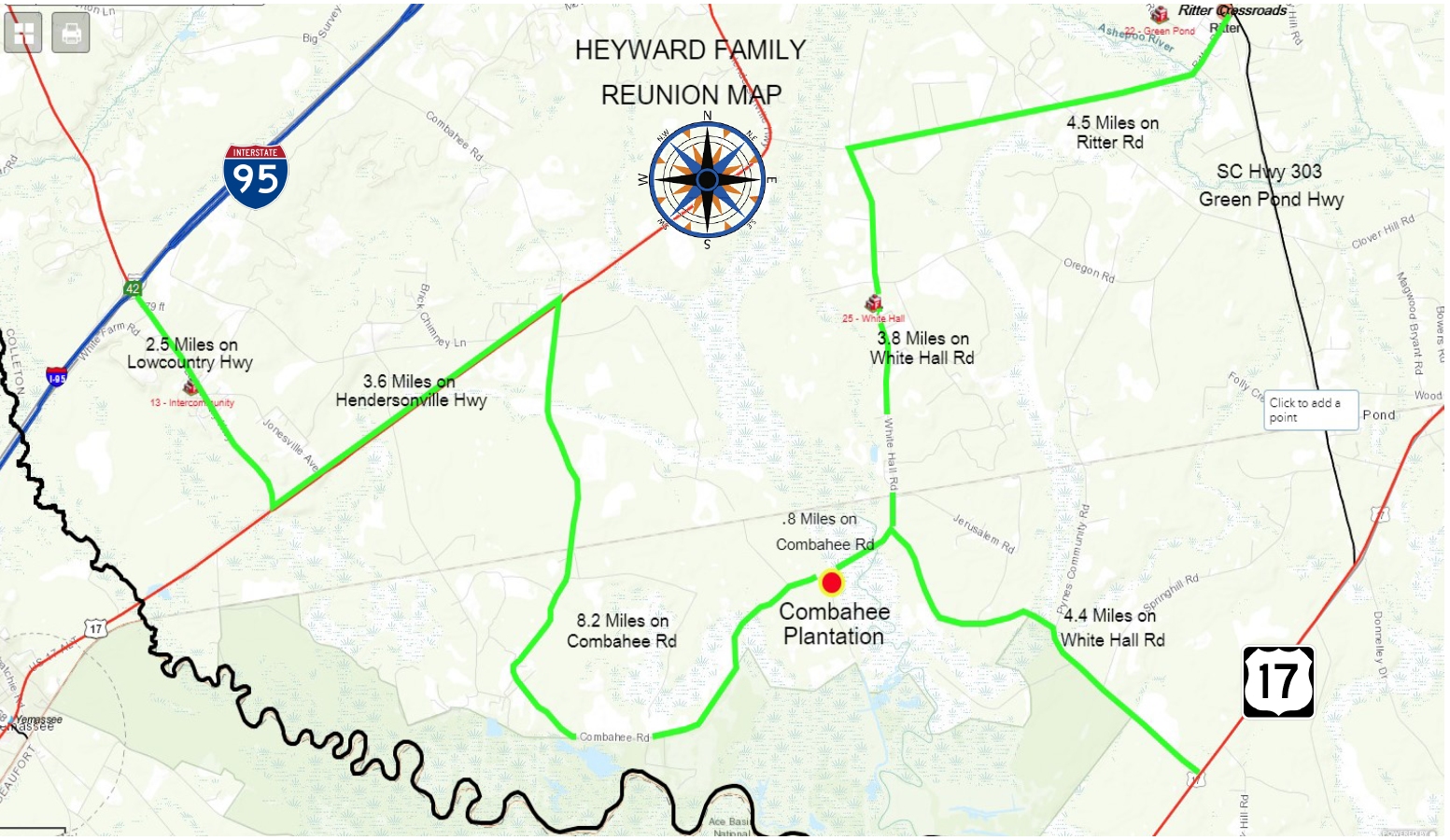
The map below shows directions to Combahee Plantation, site of the 2018 Heyward Reunion.
Directions to Combahee
The entrance to Combahee Plantation looks like this.

Combahee Plantation entry
For GPS navigation, use this address:
829 Combahee Road
Yemassee, SC 29945
Directions From:
I-95: Take Exit #42. Go southeast 2.5 miles on Lowcountry Highway. Turn left on Hendersonvile Highway (AKA Alt-17) and go 3.6 miles to Combahee Rd. Turn sharp right and go 8.2 miles to Combahee Plantation, which is on the right.
From Charleston area, via Highway 17: Travel west on Highway 17 until you come to White Hall Rd. Turn right and go 4.4 miles to Combahee Rd. Turn left onto Combahee Rd and travel 0.8 miles to Combahee Plantation, which is on the left.
From Walterboro: Go south on Highway 303 for about 10 miles and turn right on Ritter Rd. Go 4.5 miles on Ritter Rd. Turn left onto White Hall Rd. and travel 3.8 miles south until you get to Combahee Rd. Turn right onto Combahee Rd. Go 0.8 miles to Combahee Plantation, which is on the left.
From the Beaufort area: Go north on Highway 21 to Garden Corners and turn right onto Highway 17. Travel northeast on Highway 17 about 10 miles and turn left onto White Hall Rd. Travel on White Hall Rd 4.4 miles, where you will see Combahee Rd on the left. Turn left onto Combahee Rd and travel for 0.8 miles. Combahee Plantation is on the left.
* Thank you, Heyward Horton, for the map and the picture.
